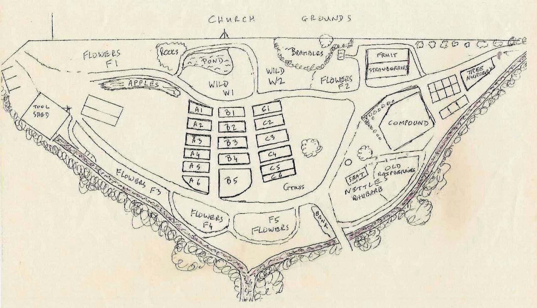
The triangular site is defined by two streams/land drains, which enter the site at the Northern and Southern extremities, and join to drain into Holes Bay to the West. These are both backed by mature trees, mostly willow, and a triangle of Oaks. Behind all these are the Tatnam Farm Allotments.
The third boundary was created when St Mary’s church was built, with a 6 foot chain fence, in a direct North/South orientation. The entrance to the site is at the end of Sherrin Close.
Barry and Andy surveyed the site, using the chain fence (convenient 6 foot gaps between posts) as a point of reference. The map below is from around 2000.

Layout of the beds in 1999
No Responses to “ Site plan ”